
England
& Wales Hardwicke Marriage Index
Marriages
1754 - 1837
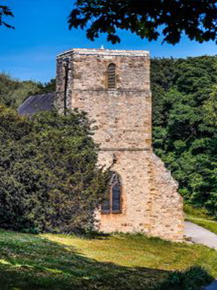
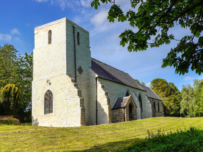
Kelloe St Helen
| |
England
& Wales Hardwicke Marriage Index |
The ParishThe parish of Kelloe lies in eastern County Durham roughly 7 miles southeast of the city of Durham. Kelloe is located a little over 2 miles north east of A177 road which links Sedgefield with the M1 Motorway. Kelloe is a place which has seen significant changes, largely as a result of the exploitation of coal. Prior to this the village of Kelloe, actually consisting of two small settlements, Town Kelloe and Church Kelloe, was a small rural pastoral farming community supported by extraction of the local limestone mainly for local building. Growth due to coal mining largely occurred post this project's period with East Hetton mine opening in 1836 and running until closure in 1983. The small compact villages of Kelloe were subsequently swamped by colliery housing and population soared from around 600 to over 11,000. Besides Kelloe, itself, the cast wider parish, around 7 miles in length, also included the townships of Cassop, Coxhoe, Quarrington, Thornley, and Wingate, covering a substantial area of the county. Modern developments have come to the area, Kelloe is surrounded by the former mineral railway lines serving the pits, many now serving new purposes as footpaths and cycle-ways, whilst the modern M1 linking Tyneside with London passes through to the west. Kelloe is drained westwards by a series of small becks, including Coxhoe Beck, all headed ultimately to the River Wesr where things turn back east to pass through Durham to the North Sea through the port of Sunderland. At the church Kelloe is sited at around 120 metres above the sea with Town Kelloe some 30 metres higher to its east. a local spot height at nearby Southern Law tops out at 177 metres the nearest and highest point in rolling countryside. As already mentioned Kelloe parish was vast, covering an area of close to 24,000 acres within which its population was steadily growing, growth from around 600 parishioners at the start of this transcript period had only reached around 1,500 by the closing date before exploding during the Victorian period to over 11,000. North of the River Tees the Normans had little influence consequently Kelloe like most of this area is not mentioned in Domesday Book. |
 |
|
|
|
| Register No | Covering Dates | Deposited With | Register Style | Quality Standard | Comments |
| 1 |
28th May 1754 - 25th May 1812 |
Durham County Record Office - Reference - EP/Ke/12 |
Standard preprinted and self-numbered combined Banns &
Marriage register with 4 entries per page |
Grade 3 Register - there are sufficient quality issues
with this register to indicate that some misreads will occur
albeit few in number |
The final 10 years of this register are rather scruffily
kept and may result in a few misreads |
| 2 | 9th September 1813 - 10th June 1837 | Durham County Record Office - Reference - EP/Ke/13 | Standard Rose style preprinted and prenumbered Marriage register | Grade 2 Register - not a perfect read but with a low likelihood of misreads | None |
|
Durham
St Oswald
|
Pittington
St Lawrence
|
|
|
Durham
St Oswald
Croxdale St Bartholomew |
 |
Castle
Eden St James
Monk Hesledon St Mary |
|
Merrington
St John the Evangelist
|
Bishop
Middleham St Michael
Trimdon St Mary Magdalene |
Sedgefield
St Edmund
|
1760 1770 1780 1790 1800 1810 1820 1830
Corrections to Tinstaafl Transcripts