
England
& Wales Hardwicke Marriage Index
Marriages
1754 - 1837
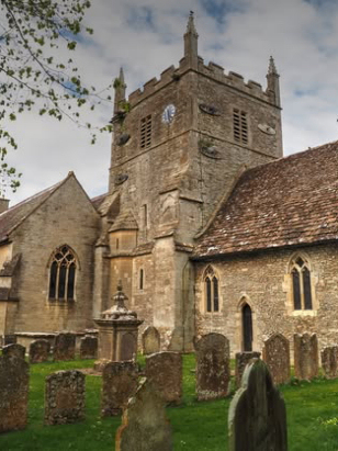
South Cerney All Hallows
| |
England
& Wales Hardwicke Marriage Index |
The ParishThe parish of South Cerney lies in the extreme southeast of Gloucestershire forming a stretch of the county's border with neighbouring Wiltshire. South Cerney is located roughly 4 miles southeast of the market town of Cirencester and sits about 1 mile west of the A419 road which links Cirencester with Swindon. South Cerney is a large village and largely cruciform in shape with a crossroads of lanes forming its core, properties line each of the lanes forming the crossroads with very little infill. The village is constrained to the southeast by the former gravel pits of the Thames floodplain now converted into leisure facilities as the Cotswold Water Park. Sitting on both the flood-plain of the Thames and with limestone of the Cotswold range within the parish South Cerney had a mixed farming regime with pastoral methods dominant, cattle on the flood-plain and sheep on the drier ground. In addition the limestone was extensively quarried for local building stone and for lime burning and, of course, the gravels of the Thames' former meandering courses was extracted for road building leaving extensive flooded pits. Modern developments have come to the parish, first to arrive was the Thames & Severn canal, now closed but once linking those two mighty rivers and targeted for its potential to be reopened, the former railway line between Cirencester & Cricklade has now closed and is partly re-purposed as a cycle & walking path, the A419 has been upgraded to fast dual-carriageway highway providing a link between the M4 & M5 motorways and carrying much heavy traffic. South Cerney is drained southeastwards by the River Churn which soon joins the Thames at Cricklade, from here it is a lengthy journey through Oxford, Reading and the capital to the North Sea. South Cerney is sited at around 90 metres above the sea in gentle terrain where only a few spots breach the 100 metre contour and those mainly to its west. South Cerney parish was typically sized for this area covering just over 2,900 acres, it would have supported a population of close to 1,050 parishioners. Already by Domesday South Cerney was a large settlement its 50 households sufficient to place it into the top 20% of settlements by population; shared between Ralph de Tosny and one Roger's son Walter tis assets of 22 ploughs, meadows and a mill made for quite a wealthy manor. |
 |
|
|
|
| Register No | Covering Dates | Deposited With | Register Style | Quality Standard | Comments |
| 1 |
13th June 1754 - 17th November 1812 |
Gloucestershire Archives - Reference - P71/IN/1/3 |
Standard preprinted and self-numbered combined Banns &
Marriage register with 4 entries per page |
Grade 2 Register - not a perfect read but with a low
likelihood of misreads |
None |
| 2 | 8th June 1813 - 7th February 1837 | Gloucestershire Archives - Reference - P71/IN/1/8 | Standard Rose style preprinted and prenumbered Marriage register | Grade 2 Register - not a perfect read but with a low likelihood of
misreads |
None |
|
Driffield St Mary
|
||
|
Shorncote All Saints,
Wiltshire
|
 |
Driffield
St Mary
Latton St John the Baptist, Wiltshire |
|
Ashton
Keynes Holy Cross, Wiltshire
|
Ashton
Keynes Holy Cross, Wiltshire
Cricklade St Sampson, Wiltshire |
Cricklade
St Sampson, Wiltshire
|
1760 1770 1780 1790 1800 1810 1820 1830
Corrections to Tinstaafl Transcripts