
England
& Wales Hardwicke Marriage Index
Marriages
1754 - 1837
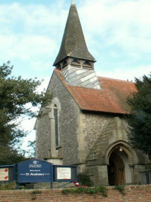
Farlington St Andrew
| |
England
& Wales Hardwicke Marriage Index |
The ParishThe parish of Farlington lies in the extreme southeast of Hampshire forming a stretch of Hampshire's coastline with Langstone Harbour and also being not too far from the county's border with neighbouring Sussex. Farlington lies about 5 miles northeast of the port and town of Portsmouth and whilst once a discrete and separate village has now been engulfed by the growing spread of Portsmouth's conurbation. Farlington once sat upon the busy A27 road which parallels the coast from Southampton through to Brighton, thankfully that busy road has been bypassed to Farlington's south.The parish is curiously shaped, being extended as thin strip from coast over the ridge of chalk and into the interior, one presumes this was done to allocate each parish a share of the land-use types available. As a consequence within Farlington there are grazing marshes bordering Langstone Harbour, sheep grazing on the chalk ridge and arable farming beyond making for a varied economy which would have been supplemented by the resources of the harbour, fishing and shell fisheries as well as wildfowl and reed. Today Farlington is very much a suburb of its near neighbour, the defending fort of Fort Purbrook still dominating local views but with a continuous stretch of housing and industry from the eastern edge of Farlington to Fareham and Portchester in the west. Modern developments include the coastal railway line from Portsmouth headed for London, Farlington not having a station and the modern A3(M) which runs northwards towards the capital to the east of Farlington. More peaceful developments include the creation of Farlington Marshes nature reserve an oasis of peace and tranquility in this very urban area. As a coastal settlement Farlington is drained by numerous small streams into nearby Langstone Harbour and thence to the English Channel. Farlington is sited at just 20 metres above the sea but the fort-topped chalk ridge just inland rises sharply to reach close to 100 metres. Farlington parish was fairly typically sized for its area, covering just over 2,300 acres it would have supported a population of close to 800 parishioners. Farlington is not specifically mentioned in Domesday Book. |
 |
|
|
|
| Register No | Covering Dates | Deposited With | Register Style | Quality Standard | Comments |
| 1 |
19th May 1754 - 28th April 1793 |
Portsmouth History Centre |
A pre-existing transcript |
Grade 5 Register - the condition of this register is such
that the transcript carries a "health warning" as to the
likelihood of being substantially incorrect |
The marriage register for this period is so badly damaged as
to be unusable, mildew and damp making it useless as a means for
collecting these 84 entries. It is fortunate that the succeeding
clerk made a transcript which is copied here to ensure accuracy
where there would have been none |
| 2 | 28th April 1793 - 9th November 1812 | Portsmouth History Centre - Reference - CHU14/A/3/1/1 | Standard preprinted and self-numbered Marriage register with 4 entries per page | Grade 2 Register - not a perfect read but with a low likelihood of misreads | None |
| 3 | 20th April 1813 - 4th October 1836 | Portsmouth History Centre - Reference - CHU14/A/3/1/2 | Standard Rose style preprinted and prenumbered Marriage register | Grade 2 Register - not a perfect read but with a low likelihood of misreads | None |
|
Catherington
All Saints
|
Bedhampton
St Thomas a Becket
|
|
 |
Bedhampton
St Thomas a Becket
|
|
|
|
|
1760 1770 1780 1790 1800 1810 1820 1830
Corrections to Tinstaafl Transcripts