
England
& Wales Hardwicke Marriage Index
Marriages
1754 - 1837
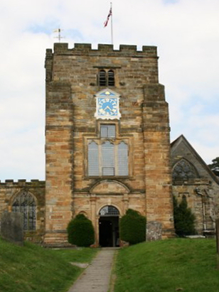
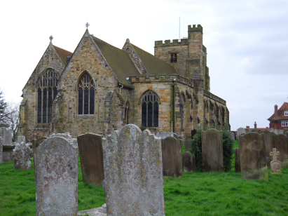
Goudhurst St Mary
| |
England
& Wales Hardwicke Marriage Index |
The ParishThe parish of Goudhurst lies in the extreme south of Kent forming a lengthy stretch of the county's border with neighbouring Sussex. Goudhurst is located roughly 9 miles east of the spa town of Tumbridge Wells and sits on the A262 road which links Lamberhurst with Tenterden. Goudhurst is a crossroads settlement and former market town sat around the junction of the A262, running west to east with the north/south running B2079. For the Normans the High Weald, in which Goudhurst sits, was one vast hunting forest, hence the paucity of entries in Domesday Book, as their hold was relinquished clearings for settlement or "hursts" were cut into the woodland. Goudhurst grew initially from the exploitation of the woodland, timber grown in the Weald is said to have hulled the Naval fleet that won against the Spanish Armada. These isolated hursts such as Goudhurst grew into regional trading centres, a market for its hinterland and a home for specialist trades. Besides exploiting the woodland environment for timber and forest products such as poles and hurdles there was limited agriculture on such poor soils so pastoral methods dominated. One specialist local crop did, however, do well and the growing of hops was a local speciality. Like many rural towns there was also an important weaving industry until collapsing following the industrial revolution's changes to mechanised production in the north. Today Goudhurst remains a local shopping and tourism destination set within an extensive and largely wooded parish with smallholdings cut into the woodland supporting small farming enterprises. Goudhurst sits on a hilltop east of the River Treise which drains the parish northwards meeting the Boult and then soon after the Medway which continues northwards to reach the North Sea through the port of Chatham and the outer Thames Estuary. Goudhurst is sited on rising ground east of the river at between 80 and 120 metres above the sea, that hill being crowned by the parish church, to the southeast near Blackbush Wood is a spot height of 136 metres the local high point. Goudhurst parish was one of the largest in its county covering just over 9,700 acres which would have supported a population of around 2,700 parishioners. Like most of the High Weald Goudhurst is not mentioned in Domesday Book. |
 |
|
|
|
| Register No | Covering Dates | Deposited With | Register Style | Quality Standard | Comments |
| 1 | 22nd July 1754 - 1st June 1792 |
Kent Archives & Local History - Reference - P157/1D/1 |
Standard preprinted and self-numbered Marriage register
with 4 entries per page |
Grade 2 Register - not a perfect
read but with a low likelihood of misreads |
None |
| 2 | 12th August 1792 - 25th December 1812 | Kent Archives & Local History - Reference - P157/1D/2 | Standard preprinted and self-numbered Marriage register with 4 entries per page | Grade 2 Register - not a perfect read but with a low likelihood of
misreads |
None |
| 3 | 18th March 1813 - 11th May 1837 | Kent Archives & Local History - Reference - P157/1D/3 | Standard Rose style preprinted and prenumbered Marriage register | Grade 2 Register - not a perfect read but with a low likelihood of
misreads |
None |
|
Horsmonden
St Margaret
|
Marden
St Michael & All Angels
|
|
|
Horsmonden
St Margaret
Ticehurst St Mary, Sussex |
 |
|
|
Ticehurst
St Mary, Sussex
|
Ticehurst
St Mary, Sussex
|
1760 1770 1780 1790 1800 1810 1820 1830
Corrections to Tinstaafl Transcripts