
England
& Wales Hardwicke Marriage Index
Marriages
1754 - 1837
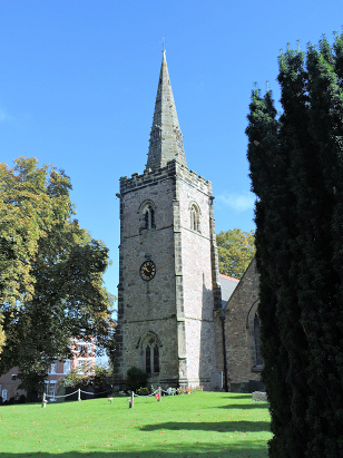
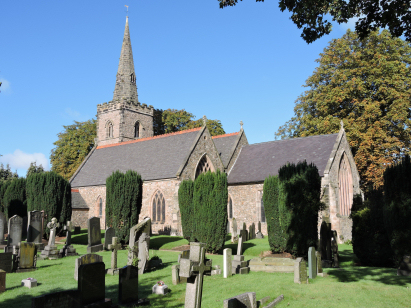
Desford St Martin
| |
England
& Wales Hardwicke Marriage Index |
The ParishThe parish of Desford lies in the western portion of central Leicestershire roughly 8 miles west of the county city of Leicester. Desford sits on the B582 road, a linking road that connects the former A46 (Roman Fosse Way) through to the A447 (Hinckley to Coalville) arriving just south of Ibstock. Desford is a large village that has grown much larger in relatively recent times, at the time of this transcript the B582 followed the village's Main Street in a convoluted route through, most properties lines that road as it performed two right-angled bends to pass from east to west. Today modern developments has expanded the village, and straightened the route of the B582, such that it forms roughly a circle of a half mile diameter; the southwestern area being the most recent developments. At the time of this transcript Desford would have split its economy two ways, farming and the ubiquitous Leicestershire industry of frame-work knitting, here producing stockings employed roughly 10% of the population. Farming was mixed with pastoral farming in the majority. Modern developments have come to the parish, the railway line between Leicester and Burton upon Trent passing through to its north without granting Desford a station. Desford is drained northeastwards by the infant Rothley Brook which joins the Soar at Rothley before heading onward to meet the Trent and make its long journey to the North Sea arriving though the Humber Estuary. Desford sits on relatively high land at around 130 metres above the sea with local heights barely reaching 10 metres higher in gently undulating terrain. Desford was quite an extensive parish for a lowland rural parish, covering just under 2,400 acres it was perhaps 50% larger than is normal, within that acreage it would have supported a population of close to 1,000 parishioners. In Domesday times Desford was altogether a much smaller place, a single household graced the settlement held by Hugh de Grandmesnil and assets of a single plough were supplemented by small acreages of meadow & woodland, an obscure rural settlement at that time. |
 |
|
|
|
| Register No | Covering Dates | Deposited With | Register Style | Quality Standard | Comments |
| 1 |
4th August 1754 - 19th May 1799 |
Leicestershire & Rutland Record Office - Reference -
DE370/9 |
Plain, unruled containing combined Banns & Marriages |
Grade 4 Register - there are notable quality issues with
this register which may have resulted in many misreads |
A scruffily kept register with a challenging hand will lead
to some misreads and there could be a few |
| 2 | 2nd June 1799 -18th August 1812 | Leicestershire & Rutland Record Office - Reference - DE370/10 | Standard preprinted and self-numbered Marriage register with 4 entries per page | Grade 3 Register - there are sufficient quality issues with this
register to indicate that some misreads will occur albeit few in
number |
Poor clerical work continues throughout this register, if
marginally better than its predecessor, misreads are still possible
as a result |
| 3 | 29th March 1813 - 6th June 1837 | Leicestershire & Rutland Record Office - Reference - DE370/11 | Standard Rose style preprinted and prenumbered Marriage register | Grade 2 Register - not a perfect read but with a low likelihood of
misreads |
None |
|
Thornton
St Peter
|
Ratby
St Philip & St James
|
Ratby
St Philip & St James
|
 |
Kirby
Muxloe St Bartholomew
|
|
|
Kirkby
Mallory All Saints
|
Peckleton
St Martin
Thurlaston All Saints |
Kirby
Muxloe St Bartholomew
Thurlaston All Saints |
1760 1770 1780 1790 1800 1810 1820 1830
Corrections to Tinstaafl Transcripts