
England
& Wales Hardwicke Marriage Index
Marriages
1754 - 1837
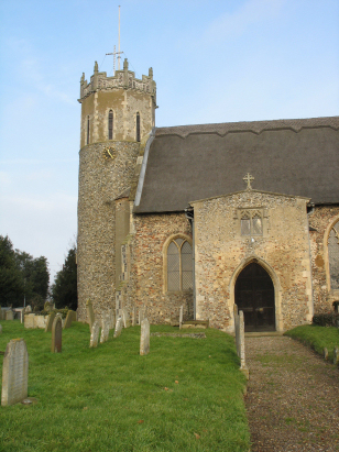
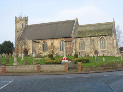
Acle St Edmund
| |
England
& Wales Hardwicke Marriage Index |
The ParishThe parish of Acle lies in eastern Norfolk roughly 11 miles east of the city of Norwich. Acle sits immediately north of the A47 road, which formerly went through but now follows a bypass to the south, which connects Norwich with Great Yarmouth. Acle is a small market town, its market was granted in the late 14th century by King Richard II, but has been much expanded in modern times. In Roman times there is evidence that the sea once reached the edge of Acle and it was a small port now it merely sits on the banks of the River Bure several miles from the coast. Early maps show a clustered settlement gathered around the market with a short southern extension to the vicinity of the church. Modern developments have added large areas of modern housing to the north, southeast and west creating a town roughly square and a mile across. Besides functioning as a centre for trade and specialist skills Acle also partook in both the local worsted weaving and also was a base for exploiting the marshlands both for reed-thatch, wildfowling and the iconic Broads wherries for internal transportation of arable produce. Other than extensive tracts of reclaimed grazing marshes the parish also had excellent soils for growing cereals on higher ground. Modern developments have come to Acle, the railway line, one of two linking Norwich with Great Yarmouth, came to Acle granting it a station and enhancing its appeal as a commuter settlement. The A47 is in the process of being upgraded to fast dual-carriageway. Acle is drained eastwards by the Bure which makes its own way independent of the other Broadland rivers to the sea arriving in Great Yarmouth east of Breydon Water and into the North Sea. Acle is sited at around 10 metres above the sea in very gentle terrain, to the west a few spots touch 25 metres in the Burlinghams. Acle parish was large in area because of the detached areas of reclaimed land assigned to it (for the sake of simplicity they are excluded from the adjacent parish list below) as well as its main body of area, covering just under 3,200 acres it would have supported a population of around 850 parishioners. In Domesday times Acle was recorded as having 65 households, large enough to be amongst the largest 20% of settlements in the land, held by King William it could muster 16 ploughs, typical meadows & woodland and had a mill. |
 |
|
|
|
| Register No | Covering Dates | Deposited With | Register Style | Quality Standard | Comments |
| 1 |
30th May 1754 - 7th December 1812 |
Norfolk Record Office - Reference - PD164/4 |
Standard preprinted and self-numbered Marriage register
with 3 entries per page |
Grade 2 Register - not a perfect read but with a low
likelihood of misreads |
None |
| 2 | 30th November 1813 - 15th June 1837 | Norfolk Record Office - Reference - PD164/5 | Standard Rose style preprinted and prenumbered Marriage register | Grade 2 Register - not a perfect read but with a low likelihood of
misreads |
None |
|
Burlingham
St Edmund
Beighton All Saints |
 |
Burgh
St Margaret (detached)
Stokesby with Herringsby St Andrew |
|
Beighton
All Saints
|
1760 1770 1780 1790 1800 1810 1820 1830
Corrections to Tinstaafl Transcripts