
England
& Wales Hardwicke Marriage Index
Marriages
1754 - 1837
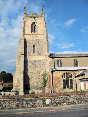
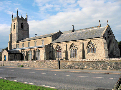
Feltwell St Mary
| |
England
& Wales Hardwicke Marriage Index |
The ParishThe parish of Feltwell St Mary, Feltwell had, for part of this transcript period, twin parish churches, St Nicholas being merged into St Mary during the period under consideration, lies in the far southwest of Norfolk forming an lengthy stretch of the border with neighbouring Cambridgeshire, it is also not too far north of the border with Suffolk. Feltwell is a large village located roughly 6 miles north of the Suffolk town of Lakenheath and which sits on, and mostly west of, the B1112 road which links Lakenheath through to Stoke Ferry. Feltwell's earliest properties are immediately west of the B1112 gathered around its twin churches, later, more modern, development has extended the village westwards into the adjacent Fenland either side of the lane which heads to Southery. The village has grown to being a substantial settlement of roughly a mile from east to west, almost market town in size. Most mappings of parish boundaries do not distinguish to which parish areas of the wider parish align so are wholly treated as belonging to St Mary given the closure of St Nicholas. Feltwell sits upon an extensive area of Norfolk's Fenland, a rich area with large flat fields today but which was mainly set to pasture at the time of this transcript, early gazetteers place almost 60% of the parish acreage as such. Today the area is almost totally devoted to growing crops, not only the typical ones of cereals, beet & oil-seed but specialist table vegetables are something of a Fenland speciality. The villagers would have supplemented their farming incomes with some weaving producing bombazine & crepe in particular. Prior to man's intervention Feltwell would have drained into the Little Ouse or the Wissey but the great Fenland drainage projects created the "Cut-Off Channel" connecting the two and most of Feltwell's water utilises that to eventually reach the Great Ouse and the North Sea through The Wash. Feltwell is sited below 10 metres above the sea, just sufficient to be above olden times flood-levels, land hereabouts is mostly below that height further west but gradually rises out of the Fen eastwards reaching almost 40 metres before the land is swallowed into the forested areas further east. The combined parish acreage of St Mary & St Nicholas was one of the most extensive in its county, covering over 14.500 acres within which it would have supported a population of close to 1,500 parishioners. In Domesday times Feltwell was equally important, sufficiently large enough to count amongst the largest 20% of settlements recorded in that book, shared between William de Warenne, Ely Abbey & the King, himself, Feltwell offered an impressive 26 ploughs, extensive meadows with much smaller woodland and also held a mill & 2 fisheries making it a very wealthy set of holdings, indeed. |
 |
|
|
|
| Register No | Covering Dates | Deposited With | Register Style | Quality Standard | Comments |
| 1 |
12th May 1754 - 12th June 1812 |
Norfolk Record Office - Reference - PD432/4 |
Standard preprinted and self-numbered Marriage register
with 3 entries per page |
Grade 1 Register - Few issues noted and a low likelihood
of misreads |
None |
| 2 | 19th January 1813 - 4th April 1837 | At the time of compilation this register was retained by the parish - film and digitised copies are available | Standard Rose style preprinted and prenumbered Marriage register | Grade 2 Register - not a perfect read but with a low likelihood of misreads | None NB It should be noted that this is a combined register for St Mary & St Nicholas |
|
Southery
St Mary the Virgin
|
||
|
Littleport
St George, Cambridgeshire
|
 |
Weeting
St Mary
Felwell St Nicholas |
|
Weeting
St Mary
Wilton St James |
1760 1770 1780 1790 1800 1810 1820 1830
Corrections to Tinstaafl Transcripts