England
& Wales Hardwicke Marriage Index
Marriages
1754 - 1837
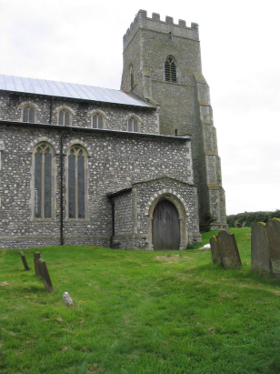
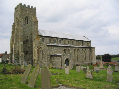
Salthouse St Nicholas
 |
England
& Wales Hardwicke Marriage Index |
The ParishThe parish of Salthouse lies on Norfolk's northern North Sea coastline roughly 4 miles north of the small market town of Holt. Salthouse sits on and mostly south of the A149 road which hugs Norfolk's coastline from Cromer to Wells next the Sea. Salthouse sits upon the former coastline where land rises abruptly from the coastal salt-marshes with most properties lying either along the A149 or on lane which climb inland from it. Salthouse has a period of relative prosperity in the Middle Ages as a port but 17th century reclamation of the marshes closed its channel to the sea and today a quarter mile of grazing marsh sits between the village and the shingle bank which prevents the sea returning to its former line. Inland the parish is arable as is most of its county but the grazing marshes hold usually cattle and sheep as well as providing a home to the countless waterfowl that frequent this coastline, a major winter home for Pink-footed Geese. Inland there are also tracts of heathland within the parish which would have been exploited as common for such products as besoms and foraging pigs. The parish's drainage to the nearby sea is largely a result of that reclamation with most water funneled to Cley next the Sea and to Blakeney Harbour for its exit. Salthouse is sited at between sea level and 20 metres above with land rising onto the heath to the south reaching 60 metres at Gravelpot Hill. Salthouse parish was typically sized for its area covering just under 1,600 acres and supporting a population of close to 250 parishioners. In Domesday times Salthouse was shared between William de Warenne and William d'Ecouis and was a wealthy holding offering 12 ploughs backed by a small meadow and some woodland, it also possessed a mill. |
 |
|
|

|
| Register No | Covering Dates | Deposited With | Register Style | Quality Standard | Comments |
| 1 |
3rd March 1755 - 10th November 1812 |
Norfolk Record Office - Reference - PD23/2 |
Standard preprinted and self-numbered Marriage register
with 3 entries per page |
Grade 2 Register - not a perfect read but with a low
likelihood of misreads |
None |
| 2 | 11th February 1813 - 13th November 1836 | Norfolk Record Office - Reference - PD23/3 | Standard Rose style preprinted and prenumbered Marriage register | Grade 2 Register - not a perfect read but with a low likelihood of
misreads |
None |
|
|
|
|
|
Cley
next the Sea St Margaret
|
 |
Kelling
St Mary
|
|
Cley
next the Sea St Margaret
|
Kelling
St Mary
|
1760 1770 1780 1790 1800 1810 1820 1830
Corrections to Tinstaafl Transcripts