
England
& Wales Hardwicke Marriage Index
Marriages
1754 - 1837
Thompson St Martin
| |
England
& Wales Hardwicke Marriage Index |
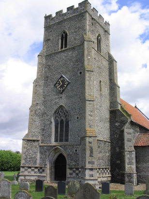
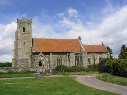
The ParishThe parish of Thompson lies in south central Norfolk about 4 miles south of the small market town of Watton. Thompson sits a little over a mile west of the A1075 road which connects Watton with Thetford. A curious settlement, Thompson consists of two distinct settlements, a triangular area grouped around a meeting of lanes together with a smaller patch by the church which lies almost a mile to the east. Thompson sits on the edges of Norfolk's Breckland, an area of poorer soils deposited during the last glacial period, these soils are less suited to arable farming and sheep and even rabbit warrenries were common in this area. The glaciers also left a legacy in the form of small round lakes, "pingoes", formed by isolated ice blocks melting after retreat leaving shallow depressions, the local pingo trail takes in many. Modern developments came and went from Thompson, the Thetford to Watton branch railway line has long since disappeared, a more recent intrusion is the STANTA Battle Area, a swathe of land commandeered during World War 2 by the military and still out-of-bounds due to military training still. A more peaceful pursuit can be found along the Peddar's Way National Trail which follows the western boundary of Thompson parish. Thompson is drained westwards by a small tributary of the River Wissey, the latter heads out to Fenland before joining the Great Ouse and the North Sea through The Wash. Thompson is sited at around 50 metres above the sea on something of a local high point, that modest height not being over-topped for many a mile. Thompson parish was fairly typically sized for Breckland, covering just over 2,200 acres it would have supported a population of just under 500 parishioners. In Domesday times Thompson was a relatively small settlement, despite offering just 7 ploughs and a small meadow it was shared by no fewer than 4 landholders. |
 |
|
|
|
| Register No | Covering Dates | Deposited With | Register Style | Quality Standard | Comments |
| 1 |
1st April 1755 - 1st November 1812 |
Norfolk Record Office - Reference - PD156/3 |
Standard preprinted and self-numbered Marriage register
with 3 entries per page |
Grade 3 Register - there are sufficient quality issues
with this register to indicate that some misreads will occur
albeit few in number |
Fading of this register, combined with sporadic challenging
writing, could lead to one or two misreads |
| 2 | 18th November 1813 - 20th February 1837 | Norfolk Record Office - Reference - PD156/4 | Standard Rose style preprinted and prenumbered Marriage register | Grade 3 Register - there are sufficient quality issues with this register to indicate that some misreads will occur albeit few in number | Fading of this register, combined with sporadic challenging writing, could lead to one or two misreads |
|
Griston
St Peter & St Paul
|
||
 |
Griston
St Peter & St Paul
Caston Holy Cross |
|
|
Stow
Bedon St Botolph
|
Stow
Bedon St Botolph
|
1760 1770 1780 1790 1800 1810 1820 1830
Corrections to Tinstaafl Transcripts