
England
& Wales Hardwicke Marriage Index
Marriages
1754 - 1837
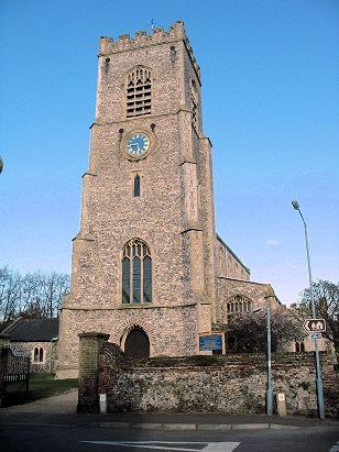
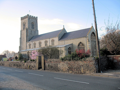
Wells next the Sea St Nicholas
| |
England
& Wales Hardwicke Marriage Index |
The ParishThe parish of Wells next the Sea. hereafter simply Wells, lies in the extreme north forming a lengthy stretch of the county's northern North Sea coastline. Wells sits on the A149 road which forms Norfolk's coast road from Cromer through to Hunstanton and sits roughly 33 miles northwest of the county town of Norwich and 10 miles north of the market town of Fakenham. Wells is a market town and port, once one of Norfolk's major sea-ports prior to silting reducing capacity. Wells has an extensive run of properties lining the creeks from west to east with a smaller inland portion close by to the church and the A149. The former market, held on Saturdays, has nowadays lapsed but the town remains a centre for trade and specialist skills. The port has also shrunk in importance as silting continuously acted to reduce capacity and required frequent dredging. Most of the trade was coastal with some with the Low Countries and Scandinavia. Exports were mainly of the local agricultural produce whilst imports of timber and coal were major inbound elements. In addition a substantial fishery operated collecting both fish and also shellfish with oysters and cockles particularly important. Some ship-building was also conducted to support those maritime interests. The wider parish, like most in Norfolk, would have been primarily arable but with a substantial acreage also under salt-marsh. Today Wells is a major tourist attraction with its harbour popular for its fish restaurants, its beaches and the extensive pine-covered dune fields to the west popular with holidaymakers and nature lovers, it is much beloved by the sailing fraternity and it is also a major stop on the Peddars Way & North Norfolk Coast National Trail. Modern developments arrived and declined, a narrow-gauge railway line from Fakenham now becoming an additional attraction in the form of a local steam line, The Wells & Walsingham Light Railway". As a coastal town most water flows readily into the nearby salt-marsh creeks to reach the North Sea. Wells is sited at between sea level and 15 metres in generally flattish terrain. Wells parish was extensive, much larger than many Norfolk parishes, it covered just over 2,300 acres and supported a population of close to 3,500 parishioners. Even by Domesday times Wells was of sufficient size as to be amongst the largest 20% of settlements by population, it was shared between no fewer than 5 landholders and with assets of 12 ploughs, some meadows and 3 mills it appeared modest, no mention of the settlements fishing capability is mentioned but undoubtedly employed many in the burgeoning settlement. |
 |
|
|
|
| Register No | Covering Dates | Deposited With | Register Style | Quality Standard | Comments |
| 1 |
2nd April 1754 - 27th December 1787 |
Norfolk Record Office - Reference - PD679/13 |
Standard preprinted and self-numbered combined Banns &
Marriage register with 4 entries per page |
Grade 2 Register - not a perfect read but with a low
likelihood of misreads |
None |
| 2 | 8th January 1788 - 29th November 1812 | Norfolk Record Office - Reference - PD679/15 | Standard preprinted and self-numbered Marriage register with 3 entries per page | Grade 2 Register - not a perfect read but with a low likelihood of
misreads |
None |
| 3 | 2nd March 1813 - 16th May 1837 | Norfolk Record Office - Reference - PD679/16 | Standard Rose style preprinted and prenumbered Marriage register | Grade 1 Register - Few issues noted and a low likelihood of
misreads |
None |
|
|
|
|
 |
||
1760 1770 1780 1790 1800 1810 1820 1830
Corrections to Tinstaafl Transcripts