
England
& Wales Hardwicke Marriage Index
Marriages
1754 - 1837
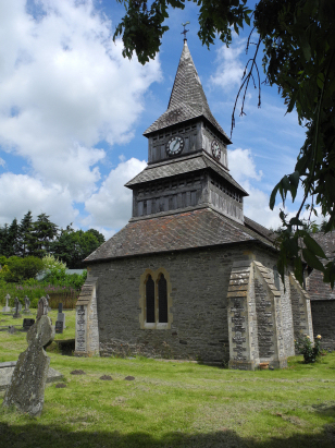
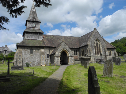
Norton St Andrew
| |
England
& Wales Hardwicke Marriage Index |
The ParishThe parish of Norton lies in the extreme east of Radnorshire forming a stretch of the border with neighbouring Herefordshire and thus also with England. Norton is located roughly 3 miles north of the small market town of Presteigne and sits on the B4355 road which links Presteigne with Knighton. Norton is a rather linear village, it sits within a deeply cut valley which constrains its growth to both east & west, with properties lining the B4355 for over a half mile, those in the south being more modern in age. The area is hilly rather than mountainous and pastoral farming, cattle in the main, dominates the local economy. Despite being in western Britain Norton also grows a few hardy crops including some cereals. Immediately west of Norton run Offa's famous dyke, designed to keep out the Welsh but nowadays followed by the Offa's Dyke National Trail, a roller-coaster path along the border which attracts some overnight stays. The Norton Brook has carbed its valley in which the village sits and it drains the parish southwards to the Lugg at Presteigne, the latter heads east and then south to meet the Wye east of Hereford and thence to the outer Bristol Channel through the port of Chepstow. Norton is already a hill village at 200 metres above the sea, outside the valley land climbs to double that height on Hawthorn Hill at 408 metres wherein runs the Off'a Dyke Trail. Norton parish, at 2,200 acres, was toward the smaller end of the scale of Radnorshire parishes, within that acreage it would have supported a population of close to 300 parishioners. As a border settlement Norton does manage an entry into Domesday Book unlike most of Wales, however it is described merely as "waste" but with ambitions for as much as 12 ploughlands all held by one Hugh the Ass, a fool or stubborn is not recorded. |
 |
|
|
|
| Register No | Covering Dates | Deposited With | Register Style | Quality Standard | Comments |
| 1 |
3rd April 1755 - 16th November 1812 |
Powys Archives - Reference - R/EP/47/R/A/5 |
Plain, unruled book containing combined Banns &
Marriages |
Grade 2 Register - not a perfect read but with a low
likelihood of misreads |
None |
| 2 | 9th June 1814 - 27th February 1837 | Powys Archives - Reference - R/EP/47/R/A/6 | Standard Rose style preprinted and prenumbered Marriage register | Grade 2 Register - not a perfect read but with a low likelihood of misreads | None |
|
Knighton
St Edward
|
Knighton
St Edward
|
|
|
Whitton
St David
|
 |
|
1760 1770 1780 1790 1800 1810 1820 1830
Corrections to Tinstaafl Transcripts