
England
& Wales Hardwicke Marriage Index
Marriages
1754 - 1837
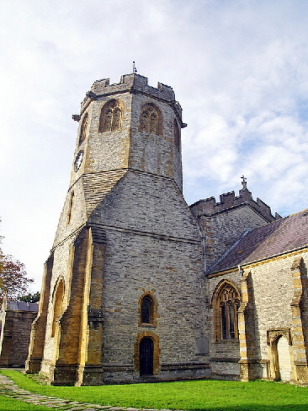
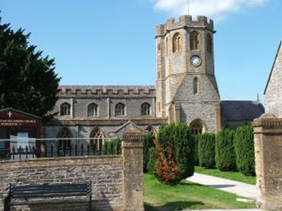
Somerton St Michael
| |
England
& Wales Hardwicke Marriage Index |
The ParishThe parish of Somerton lies in the southern portion of central Somerset roughly 6 miles southwest of the town of Glastonbury. Somerton sits upon the B3153 road which links Langport through the Somerset Levels to Castle Cary. Somerton is a large town and market for its district which has spread out from its former rather linear structure along the B3153. Early maps show a length of town stretching westwards from the market place and church for almost a half mile, today's town has spread a little further to both north and south of that route, albeit constrained northwards by the course of the River Cary. Somerton has an ancient history, believed to have been in Saxon times the chief town of its county and the seat of a royal castle, latter converted to be the county gaol. That role has long since passed to Taunton but Somerton remains a centre for specialist trades, a market for trade in the local agricultural produce, a small inland port and once a manufacturer of gloves from the hides of the local cattle, the wider parish being largely pastoral. Modern developments have come to Somerton, Brunel's Great Western Railway passes through en route to the southwest granting Somerton a station. The Cary drains the parish northwestwards,crossing the Levels to join the Parrett north of Bridgwater via the King's Sedgemoor drain, one of a number of man-made interventions to quickly drain the low-lying land, before reaching the outer Bristol Channel. Somerton sits upon rising ground, its bridge over the Cary standing at 10 metres whilst its outer suburbs rise to around 40, it sits upon one of the tracts of higher ground within the Levels reaching 86 metres on nearby Kingsdon Hill. Covering almost 7,000 acres Somerton parish was one of most extensive in its county with that acreage supporting a population of close to 2,000 parishioners. Somerton i Domesday times was already one of the largest 20% settlements recorded at that time by population, it was shared between the King and one Alfred of Spain and its assets were aplenty, an incredible 49 ploughs are recorded which are backed by meadows, pastures and woodland and its riverside setting lent it the further assets of 2 fisheries making it one of the land's wealthiest settlements of its day. |
 |
|
|
|
| Register No | Covering Dates | Deposited With | Register Style | Quality Standard | Comments |
| 1 |
1st June 1754 - 30th November 1812 |
Somerset Archives & Local Studies - Reference -
D/P/som/2/1/2 |
Standard preprinted and self-numbered combined Banns &
Marriage register with 4 entries per page |
Grade 2 Register - not a perfect read but with a low
likelihood of misreads |
None |
| 2 | 25th March 1813 - 8th June 1837 | Somerset Archives & Local Studies - Reference - D/P/som/2/1/5 | Standard Rose style preprinted and prenumbered Marriage register | Grade 2 Register - not a perfect read but with a low likelihood of
misreads |
None |
|
Walton
Holy Trinity
Compton Dundon St Andrew |
Kingsweston
All Saints
|
|
 |
Charlton
Adam St Peter & St Paul
Charlton Mackrell St Mary Kingsdon All Saints |
|
|
Long
Sutton Holy Trinity
|
Long
Sutton Holy Trinity
|
Kingsdon
All Saints
|
1760 1770 1780 1790 1800 1810 1820 1830
Corrections to Tinstaafl Transcripts