
England
& Wales Hardwicke Marriage Index
Marriages
1754 - 1837
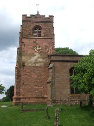
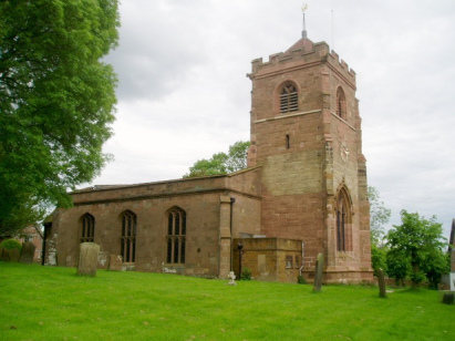
Meriden St Lawrence
| |
England
& Wales Hardwicke Marriage Index |
The ParishThe parish of Meriden lies in northwestern portion of central Warwickshire roughly 6 miles northwest of the city of Coventry. Meriden sits on the former route of the A45 road which links Birmingham with Coventry, thankfully that road now follows a bypass to Meriden's north. The original village was a largely linear affair stretching in three distinct blocks along the old A45 from that of the church in the east to Meriden Green in the west, that in the middle around Meriden Hall being the largest. Modern developments have expanded the village from the old A45 route almost as far as its newer one filling a triangular area formed between the old A45 and the B4102 which cuts across it diagonally. Meriden's chief claim to fame is its reputation for being the centre-point of England, it is certainly a long way from the sea in every direction; the fact was allegedly proven by creating a cut-out diagram of the land and finding the point of balance in every dimension, that point was Meriden. At the time of this transcript it would have primarily been a farming community, early gazetteers estimate as much as 75% of the parish acreage was set to arable. In addition there were quarries for both the local red sandstone and briefly for a harder free-stone. Modern developments have come in abundance, both the A45 and A452 are now fast dual-carriageways whilst the M6 motorway grazes the northern part of the parish. Meriden is drained northwards by the River Blythe which merges with the Anker at Tamworth to become the Tame, further north it reaches the Trent and turns eastwards on the long journey to the North Sea. Meriden sits in rising ground from 110 metres at its westernmost point to 150 metres close to its church, there is no higher ground for some distance all around. Covering almost 2,800 acres Meriden parish was a large one supporting a population of just under 1,100 parishioners. Meriden stood within the Royal Hunting Forest of Arden at Domesday and consequently was considered to be private ground for the court's use, it is therefore not mentioned in Domesday Book. |
 |
|
|
|
| Register No | Covering Dates | Deposited With | Register Style | Quality Standard | Comments |
| 1 |
27th June 1754 - 10th December 1812 |
Warwickshire County Record Office - Reference - DR0182/6 |
Standard preprinted and self-numbered Marriage register
with 4 entries per page |
Grade 3 Register - there are sufficient quality issues with this register to indicate that some misreads will occur albeit few in number | A very casual and sloppy register with poor handwriting and
incomplete entry of the marriage grids (reliant on signatures)
this will result in a few misreads |
| 2 | 3rd January 1813 - 12th June 1837 | Warwickshire County Record Office - Reference - DR0182/7 | Standard Rose style preprinted and prenumbered Marriage register | Grade 2 Register - not a perfect read but with a low likelihood of
misreads |
None |
|
Great
Packington St James
|
||
|
Great
Packington St James
|
 |
Allesley
All Saints
|
|
Hampton
in Arden St Mary & St Bartholomew
|
Allesley
All Saints
|
1760 1770 1780 1790 1800 1810 1820 1830
Corrections to Tinstaafl Transcripts