
England
& Wales Hardwicke Marriage Index
Marriages
1754 - 1837
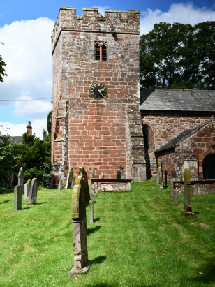
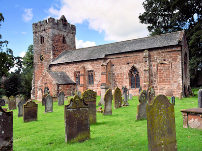
Kirkby Thore St Michael
| |
England
& Wales Hardwicke Marriage Index |
The ParishThe parish of Kirkby Thore lies in the extreme north of Westmorland forming an extensive stretch of the border with neighbouring Cumberland, it is also not too far away from Durham which borders Westmorland to its east. Kirkby Thore is located roughly 6 miles northwest of the small market town of Appleby and around 9 miles southeast of Penrith, it sits a half mile east of the busy A66 road, one of the main cross-Pennine routes between the Great North Road and Penrith, Kirkby Thore is an extensive parish which also contains licensed chapelries at Temple Sowerby & Milburn both having their individual pages within this project. Kirkby Thore is a mid-sized village sitting on the northern banks of Trout Beck at the point where it joins the River Eden, a three-way junction of lanes forms the notional centre of the village which has also grown toward the A66 in more recent times as a strip of properties alongside that lane. The village's earliest origins lie in the Roman Fort of Bravoniacum which sits southeast of the village, the A66 here follows one of the principal Roman roads of the north of England. Given its lowland setting Kirkby Thore's farming economy would have had more of an arable component than many this far north, the outer reaches of the eastern end of the parish were, however, the western flanks of The Pennines rising to its highest point at Cross Fell and most of that area was set to sheep, local Hardwicks being the best breed for such hardy conditions. Today the extraction & processing of gypsum for use in plaster employs many in the village. Modern developments have come to the parish, the iconic Settle to Carlisle railway line passes close by but does not grant Kirkby Thore a station. The Eden drains the parish northwestwards, bordering the Pennine range until passing through Carlisle to meet the Irish Sea thorugh the Solway Firth. Kirkby Thore is sited at around 120 metres above the sea but as already mentioned the east of its extensive area rises to 893 metres on toip of mighty Cross Fell. Whilst the parish is extensive from east to west it is shallow in the north/south axis and only amounts in total to just over 2,400 acres within which a population of almost 1,200 parishioners would have been supported, but 750 of these would have counted either Milburn or Temple Sowerby chapelries as their base. Like much of northern England Kirkby Thore is not mentioned in Domesday Book which has little to no coverage this far north in western England. |
 |
|
|
|
| Register No | Covering Dates | Deposited With | Register Style | Quality Standard | Comments |
| 1 |
25th June 1754 - 19th October 1812 |
Cumbria Archives - Reference - WPR36/5 |
Plain, ruled & margined book containing combined Banns
& Marriages |
Grade 2 Register - not a perfect read but with a low
likelihood of misreads |
None |
| 2 | 30th April 1814 - Undated entry 1837 | Cumbria Archives - Reference - WPR36/6 | Standard Rose style preprinted and prenumbered Marriage register | Grade 2 Register - not a perfect read but with a low likelihood of misreads | None |
|
Alston
St Augustine, Cumberland
|
||
 |
Alston
St Augustine, Cumberland
Dufton St Cuthbert |
|
|
Morland
St Laurence
Bolton All Saints |
Dufton
St Cuthbert
Long Marton St Margaret St St James |
1760 1770 1780 1790 1800 1810 1820 1830
Corrections to Tinstaafl Transcripts