
England
& Wales Hardwicke Marriage Index
Marriages
1754 - 1837
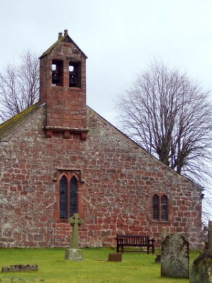
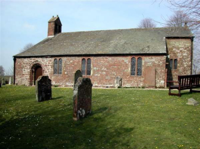
Milburn St Cuthbert
| |
England
& Wales Hardwicke Marriage Index |
The ParishMilburn parish is situated in the far northeast of Westmorland, bordering neighbouring Cumberland. Formerly a chapelry of Kirkby Thore parish, the parish was formed in 1753 in its own right. Milburn sits on the edge of the Pennines, indeed the highest hill in the Pennine chain, Great Dun Fell, lies about 4 miles northeast of the village. Milburn is away from all major roads being some 3 miles east of the Pennine crossing A66 which run from Penrith across into Durham and North Yorkshire. The village sits on a Roman road (Maiden Way) and probably has its origins as a way station on that route. The village is compact and upland at 200 metres above sea level. The parish is largely upland grazing and covers just over 5,000 acres, there is a compact village where most of the parishioners live the head count being approximately 350. In common with most of northern England Milburn was not mentioned in Domesday book. |
 |
|
|
|
| Register No | Covering Dates | Deposited With | Register Style | Quality Standard | Comments |
| 1 | 11th June 1754 - 14th November 1812 | Cumbria Archives - Kendal - Reference - WPR
47/1/2/1 |
Plain, ruled book containing combined Banns & Marriages | Grade 2 Register - not a perfect read but with a low likelihood of misreads | None |
| 2 | 6th February 1815 - 18th May 1837 | Cumbria Archives - Kendal - Reference - WPR
47/1/2/1 |
Standard Rose style preprinted and prenumbered Marriage register | Grade 2 Register - not a perfect read but with a low likelihood of misreads | None |
|
Kirkland
St Lawrence, Cumberland
Alston St Augustine, Cumberland |
Alston
St Augustine, Cumberland
|
|
|
Newbiggin
St Edmund
|
 |
Dufton
St Cuthbert
|
|
Long
Marton St Margaret & St James
|
Long
Marton St Margaret & St James
|
1760 1770 1780 1790 1800 1810 1820 1830
Corrections to Tinstaafl Transcripts