
England
& Wales Hardwicke Marriage Index
Marriages
1754 - 1837
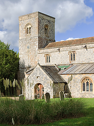
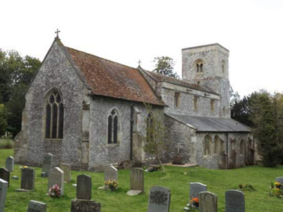
Figheldean St Michael
| |
England
& Wales Hardwicke Marriage Index |
The ParishThe parish of Figheldean lies in eastern Wiltshire forming a tiny stretch of the county's border with neighbouring Hampshire. Figheldean is located about 4 miles north of the market town of Amesbury, within the valley of Wiltshire's Avon, and sits on the river's eastern banks opposite the course of the A345 road which links Amesbury with Pewsey and on to Marlborough. Figheldean is a linear settlement lining the course of the river for over a half mile, the wider parish rises in a thin strip eastwards to the county border as chalk downland. That chalk downland is an ancient landscape dotted with barrows and tumuli and with the county border marked by the ancient fortification of Devil's Ditch. Today, however, much of the area's mapping is covered by red warnings indicating it the property of the Armed Forces who use much of Salisbury Plain for military training. Chalk gives a thin and poor soil marred by flints so farming was, at the time of this transcript, largely grazing by sheep, today it is much more arable. Besides farming the chalk was quarried extensively both for building stone and also for burning to create lime to improve soils. Figheldean is drained southwards by the Avon which passes through Amesbury & Salisbury en route to the English Channel arriving through Christchurch Harbour. Figheldean is sited at around 90 metres above the sea in its valley setting, land rises in rolling hills away from the Avon reaching 161 metres at Dunch Hill on the Devil's Ditch. Figheldean parish was thin from north to south yet extensive east to west covering in all about 5,600 acres, that acreage would have supported a population of around 500 parishioners. In Domesday times Figheldean was a smaller place held by one Harding, its assets of 5 ploughs, meadows and pastures supplemented by a mill on the Avon were typical of a small rural holding at that time. |
 |
|
|
|
| Register No | Covering Dates | Deposited With | Register Style | Quality Standard | Comments |
| 1 |
5th July 1754 - 12th November 1760 |
Wiltshire & Swindon History Centre - Reference -
PR125/1/2 |
Plain, unruled book, a continuation of the extant
composite register in contravention of Hardwicke's segregation
& wording requirements |
Grade 1 Register - Few issues noted and a low likelihood
of misreads |
None |
| 2 | 23rd August 1761 - 14th October 1801 | Wiltshire & Swindon History Centre - Reference - PR125/1/9 | Standard preprinted and self-numbered Marriage register with 4 entries per page | Grade 2 Register - not a perfect read but with a low likelihood of
misreads |
None |
| 3 | 6th May 1802 - 9th November 1812 | Wiltshire & Swindon History Centre - Reference - PR125/1/10 | Standard preprinted and self-numbered Marriage register with 4 entries per page | Grade 1 Register - Few issues noted and a low likelihood of misreads | None |
| 4 | 28th January 1813 -28th March 1837 | Wiltshire & Swindon History Centre - Reference - PR125/1/11 | Standard Rose style preprinted and prenumbered Marriage register | Grade 3 Register - there are sufficient quality issues with this
register to indicate that some misreads will occur albeit few in
number |
Poor handwriting at times in this register may result in one or
two misreads |
|
Netheravon
All Saints
|
Netheravon
All Saints
Fittleton All Saints |
|
|
Shrewton
St Mary
Rollestone St Andrew |
 |
South
Tidworth St Mary, Hampshire
|
|
Rollestone
St Andrew
|
Milston
St Mary
|
1760 1770 1780 1790 1800 1810 1820 1830
Corrections to Tinstaafl Transcripts