
England
& Wales Hardwicke Marriage Index
Marriages
1754 - 1837
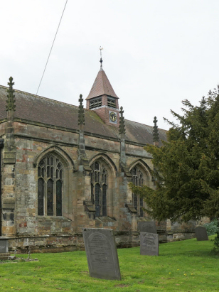
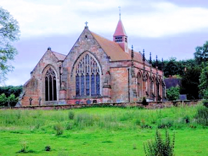
Merevale Our Lady
| |
England
& Wales Hardwicke Marriage Index |
The ParishThe parish of Merevale lies in northern Warwickshire not too far from the county's border with neighbouring Leicestershire. Merevale sits roughly 7 miles northwest of the industrial town of Nuneaton and about 1 mile south of the A5 road linking Tamworth through towards Hinckley & Nuneaton. Merevale was an estate-based parish, created from the grounds of the 12th century Cistercian Abbey and continued as the estate of Merevale Hall. There are few remains of the Abbey merely parts of the refectory and some anonymous stretch of walling. The Hall, resembling a castle with an embattled tower and walls, dates from the middle of the 19th century. Of more normal properties there are few signs of anything resembling a village. Despite the estate nature of the parish it was surprisingly industrial with a coal mine operating for many years, it lives on in the name of Colliery Farm west of the church. The remainder of the economy would have been driven by the needs of the estate with pastoral farming dominant over arable. To the south lies an extensive woodland area, Monks Park Wood, which would have been coppiced for woodland products and a source of wild meat. Modern developments all skirt the northern edges of the parish keeping to the same corridor as the A5 which in its turn follows the Roman Watling Street and is now a fast dual-carriageway, the first to arrive was the Coventry Canal soon followed by the railway line linking Nuneaton with Tamworth. Streams through the estate grounds have been landscaped to water-bodies but all drain northwards into the River Anker which forms the county border, the Anker meets the Tame and in turn the Trent before partaking in that mighty river's long journey to the North Sea arriving through the Humber Estuary. Merevale is sited at between 90 & 150 metres above the sea on rising ground from northwest to southeast, further south the highest ground is at Bentley Common where a spot height records 177 metres. Merevale parish was fairly typically sized for its area covering a little over 2,200 acres and supporting a population of close to 300 parishioners. Merevale is not mentioned in Domesday Book. |
 |
|
|
|
| Register No | Covering Dates | Deposited With | Register Style | Quality Standard | Comments |
| 1 |
24th July 1754 - 9th November 1812 |
Warwickshire County Record Office - Reference - DRB0010/3 |
Standard preprinted and self-numbered combined Banns &
Marriage register with 4 entries per page |
Grade 2 Register - not a perfect read but with a low
likelihood of misreads |
None |
| 2 | 18th October 1813 - 18th May 1837 | Warwickshire County Record Office - Reference - DRB0010/5 | None-standard Rose style preprinted Marriage register, it is non-standard in not being pre-stamped with its numbering that being left to the clerk to complete | Grade 3 Register - there are sufficient quality issues with this register to indicate that some misreads will occur albeit few in number | Poor handwriting in this register may result in one or two misreads |
|
Baddesley
Ensor St Michael
|
Mancetter
St Peter
|
|
|
Baxterley
|
 |
Mancetter
St Peter
|
|
Mancetter
St Peter
|
1760 1770 1780 1790 1800 1810 1820 1830
Corrections to Tinstaafl Transcripts